8

Septentrio - AsteRx-U3: ruggedized GNSS receiver for demanding applications

High-precision GNSS* positioning solutions provider Septentrio, has announced the launch of AsteRx-U3, which is the successor of the popular AsteRx-U multi-frequency GNSS receiver for construction, mining…

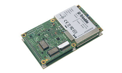
2022-05-16 | Septentrio | Belgium

OEM solution for Mobile Mapping from Applanix

Applanix has announced the launch of the Trimble AP+ Land OEM solution which offers accurate and robust position and orientation for georeferencing sensors and positioning vehicles in land mobile mapping…

2022-02-21 | Applanix | Canada

Seequent Upgrades Mine Modelling Software

Seequent launched new releases for its mining solutions Leapfrog Geo, resource modeling solution Leapfrog Edge, model management solution Seequent Central and View. Leapfrog Geo 4.5 includes performance…

2019-06-20 | Seequent | New Zealand

Hexagon’s New Early-warning Radar System Detects Rockfalls

Hexagon AB recently announced IDS GeoRadar RockSpot, a radar system that fills a gap in the monitoring of natural and engineered slopes. The system detects, tracks, and analyzes the slightest movements…

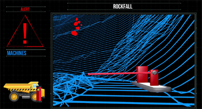
2019-05-31 | IDS GeoRadar | Italy

Stability Monitoring System for Frigid Climates

Maptek released a cold climate model of its Sentry system for stability monitoring. The company reported it redesigned all the major components in the standard- temperature Sentry mobile system to achieve…

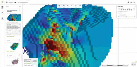
2019-04-24 | Maptek | United States

Inmarsat, Knight Piésold Offer Remote Tailings Dam Monitoring

Satellite communications provider Inmarsat announced it will be joining forces with Knight Piésold UK to deliver highly accurate tailings dam monitoring, analysis and real-time management capabilities…

2019-03-26 | Inmarsat | United Kingdom

Probe Measures B and dB/dt Fields

Abitibi Geophysics launched the ARMIT 3 probe, which simultaneously measures the B and dB/dt fields, enabling the detection of a wide range of conductors. The probe has a low noise envelope, facilitating…

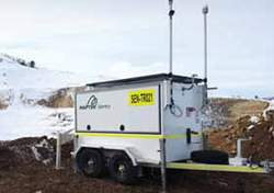
2018-04-24 | Abitibi Geophysics | Canada

Smaller, Lighter, Faster Laser Scanner

Maptek announced the I-Site SR3, a 600-m-range laser scanner. The R3 series is 30% smaller and 25% lighter than predecessor technology, with 2.5 times faster data acquisition than the company’s I-Site…

2018-04-18 | Maptek | United States