2nd Hand Equipment - Coming soon!
We are now putting the final touches to the World Mining Equipment 2nd Hand market place. If you would like information on this service contact

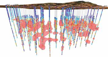
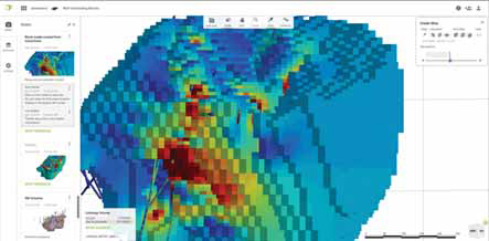
Seequent reported it released Target for ArcGIS Pro. The Esri-integrated solution simplifies the importing, viewing and analysis of drill hole and subsurface geological data within ArcGIS Pro to allow geoscientists, geologists and GIS analysts to make timely decisions on project viability and enable faster discoveries, the company reported.
The software allows users to: import, visualize and interpret drilling data; view drill hole data by numeric or categorical attributes in 2D maps and 3D scenes; create cross sections; incorporate subsurface datasets; navigate the subsurface quickly and easily using 3D navigation shortcuts; share and collaborate using Esri’s online workflows.
It is available as a free and licensed version.
http://www.geosoft.com