10

Wingtra Announce Launch of LIDAR Drone Solution

Wingtra has announced the launch of its LIDAR drone solution, which it says is a significant advancement in drone LIDAR technology. The new Wingtra LIDAR payload integrates the features of WingtraOne…

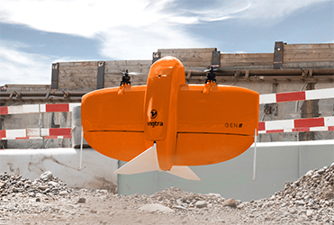
2024-02-12 | Wingtra AG | Switzerland

Stantec Appoints New Chief Technology Officer

Stantec has appointed Shankar Kalyana as chief technology officer (CTO). The IBM veteran brings nearly 40 years of experience and will be responsible for leading identification, deployment, application,…

2023-11-01 | Stantec | Canada

Septentrio - AsteRx-U3: ruggedized GNSS receiver for demanding applications

High-precision GNSS* positioning solutions provider Septentrio, has announced the launch of AsteRx-U3, which is the successor of the popular AsteRx-U multi-frequency GNSS receiver for construction, mining…

2022-05-16 | Septentrio | Belgium

OEM solution for Mobile Mapping from Applanix

Applanix has announced the launch of the Trimble AP+ Land OEM solution which offers accurate and robust position and orientation for georeferencing sensors and positioning vehicles in land mobile mapping…

2022-02-21 | Applanix | Canada

Wingtra launches WingtraOne GEN II

After six years in development and 100'000 flights, Wingtra, the professional drone producer, is launching WingtraOne GEN II, a next-generation VTOL drone that offers industrial reliability and mapping…

2021-09-01 | Wingtra | Switzerland

Drill hole, Geology Data Analysis Software

Seequent reported it released Target for ArcGIS Pro. The Esri-integrated solution simplifies the importing, viewing and analysis of drill hole and subsurface geological data within ArcGIS Pro to allow…

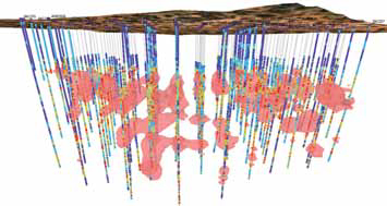
2019-12-16 | Seequent | New Zealand

Carlson Upgrades Includes New Tools and Enhancements

Carlson Mining 2020 features upgrades to existing options, new tools, and functionality enhancements. The package includes three modules Geology, Surface Mining, and Underground Mining. It runs on AutoCAD…

2019-11-25 | Carlson Software | United States

Hexagon’s New Early-warning Radar System Detects Rockfalls

Hexagon AB recently announced IDS GeoRadar RockSpot, a radar system that fills a gap in the monitoring of natural and engineered slopes. The system detects, tracks, and analyzes the slightest movements…

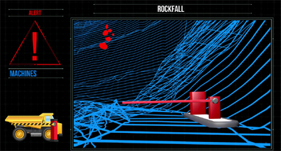
2019-05-31 | IDS GeoRadar | Italy

Maptek - Mine Scheduling Optimization Software Upgrade

Mine Scheduling Optimization Software Upgrade Maptek announced Evolution 5, an upgrade to the company’s mine scheduling optimization software, which features an updated interface for scheduling with…

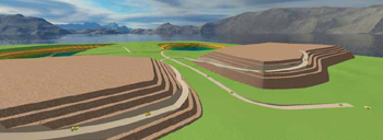
2018-05-28 | Maptek | United States

Smaller, Lighter, Faster Laser Scanner

Maptek announced the I-Site SR3, a 600-m-range laser scanner. The R3 series is 30% smaller and 25% lighter than predecessor technology, with 2.5 times faster data acquisition than the company’s I-Site…

2018-04-18 | Maptek | United States